What is LiDAR Annotation in Autonomous Vehicles? 29 Oct 2025
The perception of autonomous cars is achieved by using a combination of highly sophisticated sensors and machine learning algorithms. LiDAR (light detection and ranging) is one of the sensors, playing a major role in helping normal vehicles to detect objects, measure distance, and get them across safely. But LiDAR’s real no-fluff power exists in its highly annotated data—and this process is called ‘LiDAR annotation.’
In this article, we look in depth at what LiDAR annotation means, where it fits into the self-driving car ecosystem, and how its influence is shaping our future of driverless movement.
An Overview of LiDAR and How it Plays a Part in Autonomous Driving
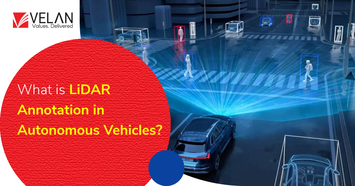
LiDAR sensors function by sending out laser beams that reflect off the world and, in turn, are used to record 3D data points—millions of them—every second. Collectively, these points are a 3D point cloud—a dense descriptor of an environment that contains objects such as cars, pedestrians, road signs and trees.
What LiDAR does for self-driving cars:
- Detect and classify surrounding objects.
- Real-Time distance measurements and displacement tracking
- Generate three-dimensional maps of driving scenes.
- Accurately Navigate—You can identify the location even in low-light conditions.
But raw LiDAR data is not in a structured form. To teach AI models properly, this data has to be labeled—placing devices and shapes by name and in relation to each other.
What is LiDAR Annotation?
LiDAR annotation is the process of labeling and classifying objects in 3D point cloud data obtained by LiDAR sensors. This annotated data is what allows autonomous cars to truly understand their world. With accurately labeled LiDAR data, the system can identify different objects and understand their locations and distances in three dimensions.
3D Bounding Boxes
It refers to drawing boxes around 3D objects like cars, humans, traffic cones or other things from the surroundings. These boxes establish the exact size, shape and position of each object in the LiDAR data that vehicles use to see their surroundings accurately.
Semantic Segmentation: Classifying each point from the LiDAR data into a class, like object type or surface (road, car, tree and so on).
Instance Segmentation: Locating objects, specifically isolating each example (many cars in one image) of a class.
Polyline annotation: Annotating the edges of roads, lanes or boundaries to aid in navigation.
Fusion Annotation: Using LiDAR with camera or radar to augment scene understanding.
They make LiDAR data interpretable such that self-driving vehicles are able to take real-time driving actions with certainty.
The importance of LiDAR annotation in autonomous vehicle development
Correct LiDAR annotation is a must for the development of effective autonomous driving systems. Here’s why:
Improved Object Detection and Tracking
Precise labeling in 3D point clouds enables robots and autonomous vehicle systems to better identify, predict, and follow objects even where they occur naturally—in the real world.
Enhanced Depth and Distance Perception
Highly annotated LiDAR data offers extremely accurate depth information, letting the vehicle know how far away an object is and accurately predicting its motion.
Improved Sensor Fusion
LiDAR information can be correlated with camera/radar data under sensor fusion annotation. This multiple sensor system enhances total perception and compensates for errors resulting from the environment.
Safety and Reliability
Vehicles require decisions in real-world situations that can be very dynamic. Well-labeled ground-truth LiDAR datasets are important for the training of such algorithms that can detect all potential hazards and act fast to protect the safety of passengers.
Regulatory and Testing Compliance
A dependable annotated corpus can aid automakers and AI developers in complying with testing and safety requirements when deploying self-driving systems on public roads.
How LiDAR Annotation Works
LiDAR annotation is a process that has various steps to perform:
- Data Collection – Raw 3D data are collected by the LiDAR sensors fixed on vehicles while driving.
- Preprocessing data—The acquired data are filtered, and the noise is removed.
- Annotation and Tagging—Trained specialists, with the help of specially designed software, visually identify and label the objects of interest in 3D point cloud data.
- Quality Control—The data from every single set is verified thoroughly to ensure correctness and good quality and to check if the data meets the project requirements.
- Integration and Training – After the labeling process, the labeled data gets connected with learning systems to help the creation and testing of autonomous driving algorithms.
Driven by factors such as scalability, accuracy, and cost-effectiveness, a great number of companies have decided to outsource the heavy and labor-intensive task of AV data annotation to third-party vendors who specialize in AI-driven services.
Challenges in LiDAR Annotation
Even though LiDAR annotation is a vital point, it can be a difficult task because of the following reasons:
– Large and unstructured datasets
– Overlapping or partially visible objects
– Different environmental factors (such as rain, fog, or glare)
– The necessity of 3D labeling by hand
In order to solve these issues, professional LiDAR annotation services have human annotators as well as AI-assisted tools that speed up the process and keep the accuracy at a high level.
Perspective of LiDAR Annotation in Autonomous Driving
With the advancement of self-driving technology, there are now less expensive and more accurate LiDAR sensors. These are the things that can be expected from LiDAR annotation in the future:
- Greater automation through AI-assisted labeling
- Better sensor fusion labelling for holistic environmental perception
- Battery-included, large-scale and standardized LiDAR datasets for algorithm evaluation
As a result of these advances, autonomous vehicles will become progressively more efficient and safer.
Conclusion
LiDAR labeling is also the core of how self-driving cars “see” and sense their environments. With precise 3D point cloud content labeling and sensor fusion annotation, LiDAR data is converted from raw measurement information into useful knowledge.
With competition for the race to full autonomy increasing, companies purchasing premium LiDAR annotation services now will be the ones holding the keys in regard to safety, innovation and real-world reliability.
FAQ
What do we use LiDAR data for in self-driving vehicles?
LiDAR data allows self-driving vehicles to detect obstacles, accurately measure distances, and map their environment, allowing safe and efficient movement.
Why is LiDAR annotation important?
It turns unprocessed LiDAR scans into labeled data that trains AI systems to recognize objects and make driving decisions.
What are LiDAR annotation services?
These are professional services that will label your 3D point cloud data for use cases such as autonomous driving, robotics, and mapping.
What exactly is sensor fusion annotation?
It fuses camera or radar sensors with LiDAR for richer multi-sensor perception of the world for higher accuracy.